About Anthony Nick
Data Analyst, Web Developer & Creator of the Local Crime Level IndexBiography
Anthony Nick is an independent data analyst and full-stack web developer with over 25 years of experience turning complex databases into intuitive, user-friendly digital products. He combines backend engineering with geospatial data science to make municipal public statistics transparent and actionable for travelers, residents, and urban researchers.
He is the author of the Local Crime Level Index, an analytical model that evaluates street‑level safety using official police and municipal datasets. By processing raw data from open portals and police feeds, the index transforms fragmented statistics into consistent, verifiable geographic assessments.
His interest in urban safety data began in 2011, when he first researched NYC crime patterns before a trip to New York. That research has since evolved into a refined methodology now applied to four global capitals.
Previously, Anthony founded a web development company in the USA (2002) and spoke at conferences on internet marketing — including a 2007 presentation of a user flow visualization tool years before similar features appeared in Google Analytics. He brings this rare combination of technical depth, analytical rigor, and real‑world entrepreneurial experience to every project.
![]()
Contact Anthony Nick: email
The Safe Areas Project
Anthony created the Safe Areas mapping network as a practical implementation of the Local Crime Level Index. The framework helps travelers, expats, and locals navigate urban environments with greater situational awareness. Currently, the index covers four major metropolitan hubs:
- New York City: SafeAreasNYC.com
- London: SafeAreasLondon.com
- Berlin: SafeAreasBerlin.com
- Paris: SafeAreasParis.com
External Resources & Publications
Anthony shares his research, analysis, and project updates across different platforms, each serving a specific purpose:
- Substack — In‑depth, analytical posts. Here Anthony publishes his most detailed research, including deep dives into why official crime maps fail citizens and how police agencies handle public crime data across New York, London, Berlin, and Paris.
- Medium — Journalistic-style articles. Anthony comments not only on his own work but also critically reviews crime maps created by others (independent developers, media outlets), offering alternative, more useful approaches for travelers and residents.
- Quora — Practical safety answers. Anthony responds to real questions from people planning trips or moves.
- X (Twitter) & Blogspot — Short announcements. Used to notify about new long‑form content on Substack, Medium, or Quora, plus project updates and minor news.
Curated City Crime Map Archives
As part of his ongoing research into urban safety, Anthony maintains public Pinterest archives for each city. These boards collect crime maps published at different times by official agencies, independent developers, civic technologists, media outlets, and academic researchers. Each board is a reference library — not original work, but a curated resource for data lovers, urban researchers, and anyone interested in the geography of crime and safety.
- New York City Crime Maps Archive
- London Crime Maps Archive
- Berlin Crime Map Collection
- Paris Crime Map Collection
Project Announcements on Facebook
For each city in the Safe Areas network, Anthony maintains a dedicated Facebook page. These pages are used to share finalized project updates, major milestones, and key findings — without day‑to‑day development notes or personal commentary.
- Safe Areas NYC (Facebook)
- Safe Areas London (Facebook)
- Safe Areas Berlin (Facebook)
- Safe Areas Paris (Facebook)
Photographs of Anthony Nick

Fieldwork, New York City, 2011.
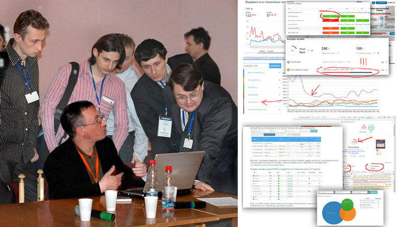
Anthony Nick leading an analytics workshop at an conference, 2007.